The software consists of desktop applications for creating maps and the gView server for publishing the maps as map services (WMS, GeoServices REST, etc).
gView Carto and gView DataExplorer runs on windows and require die .NET Framework >=4.7.2 gView Server is fully .NET Core (AspNetCore 3.1.x). It can run on windows, linux, mac and as a docker container
Download the leatest release as ZIP from Releases Unzip and run...
Read the installation documentation::
Some screenshots to demonstrate some of the features of gview GIS
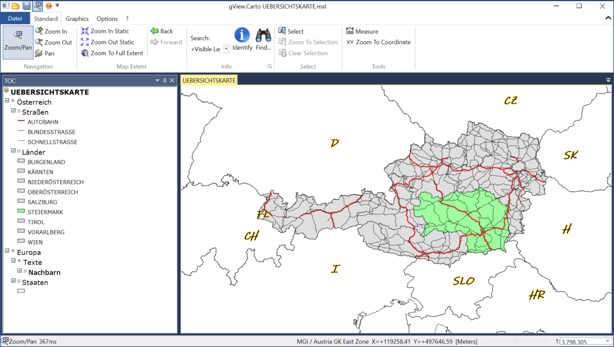
Create maps in an userfriendly UI
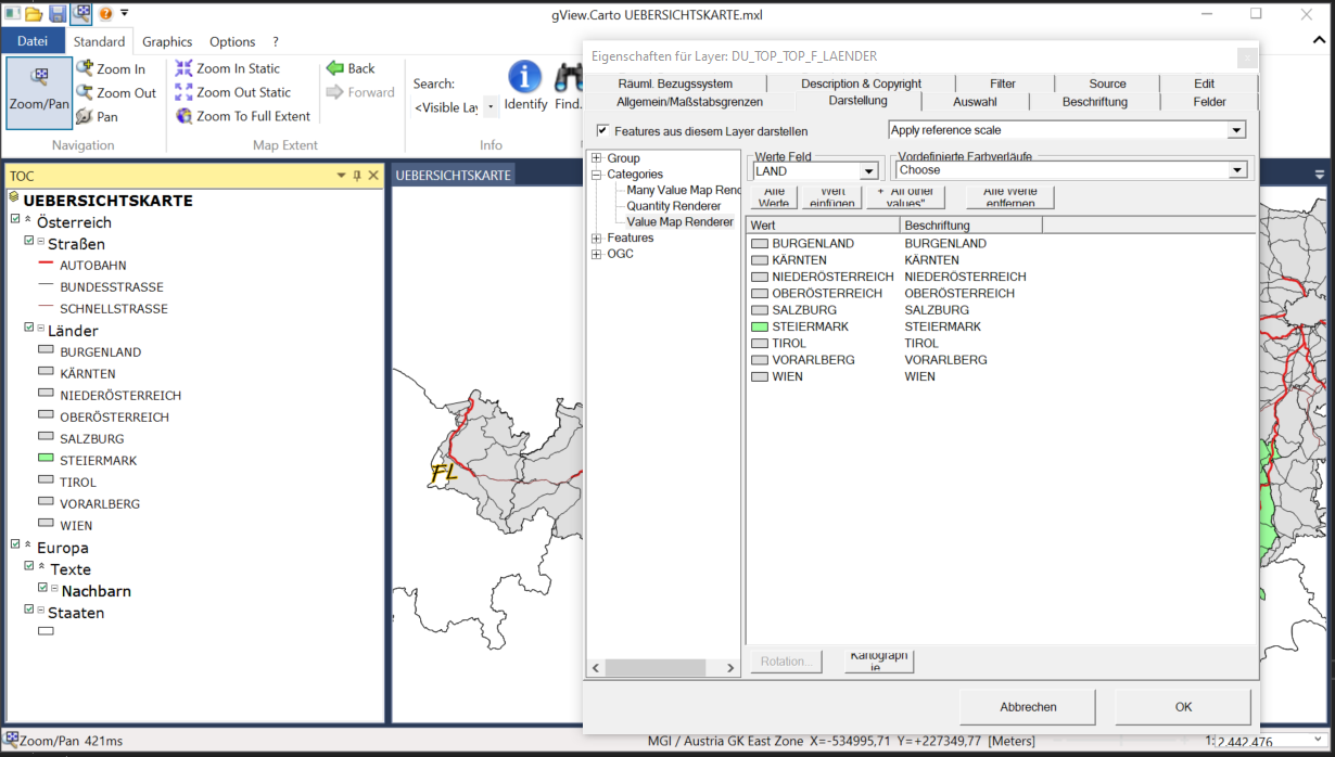
Set rendering for each layer
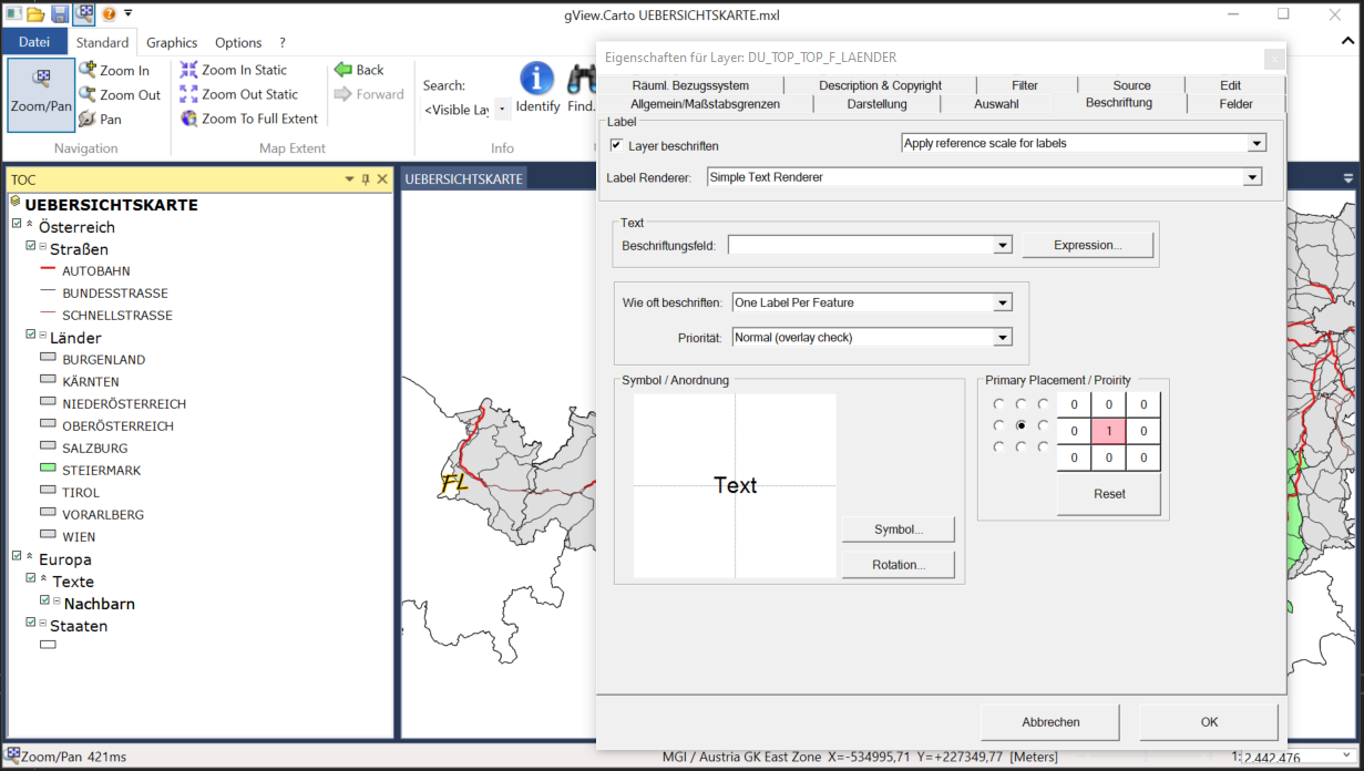
Set labelling for any vector layer
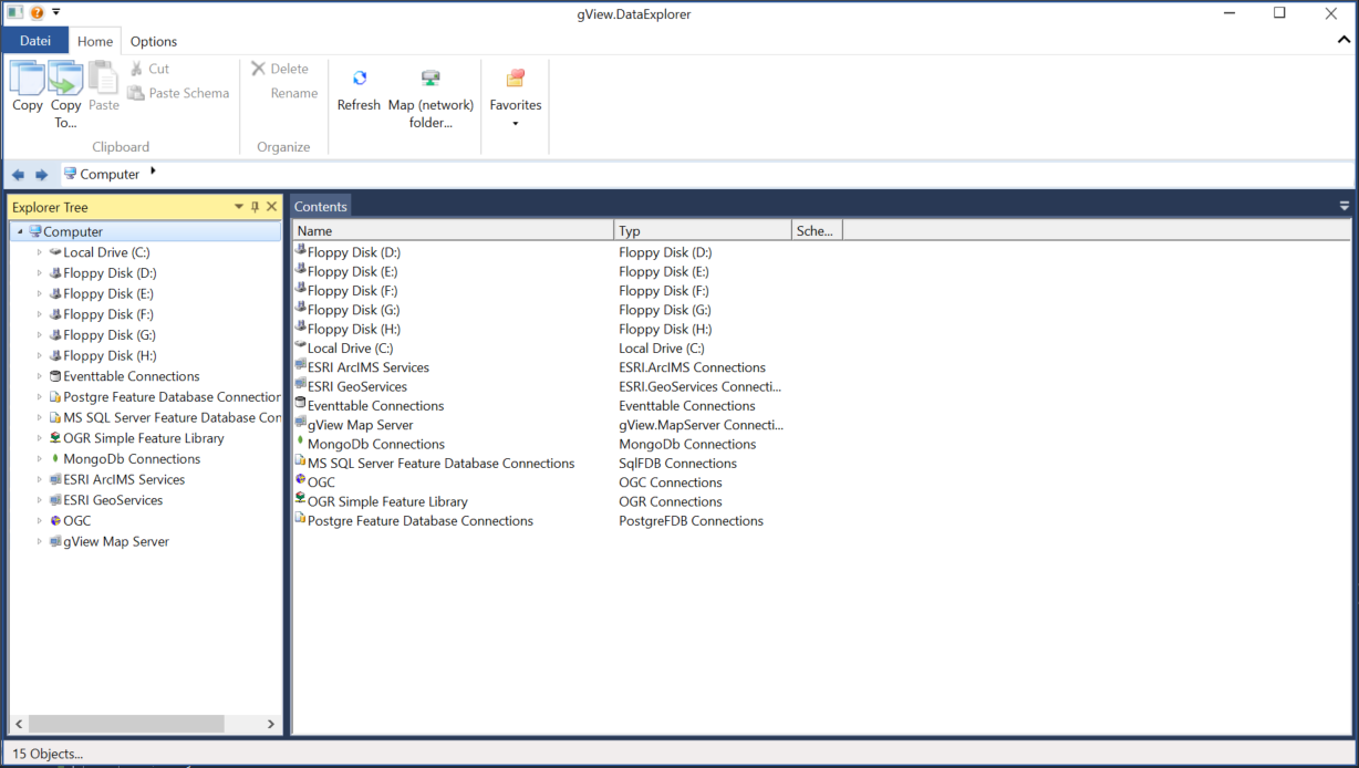
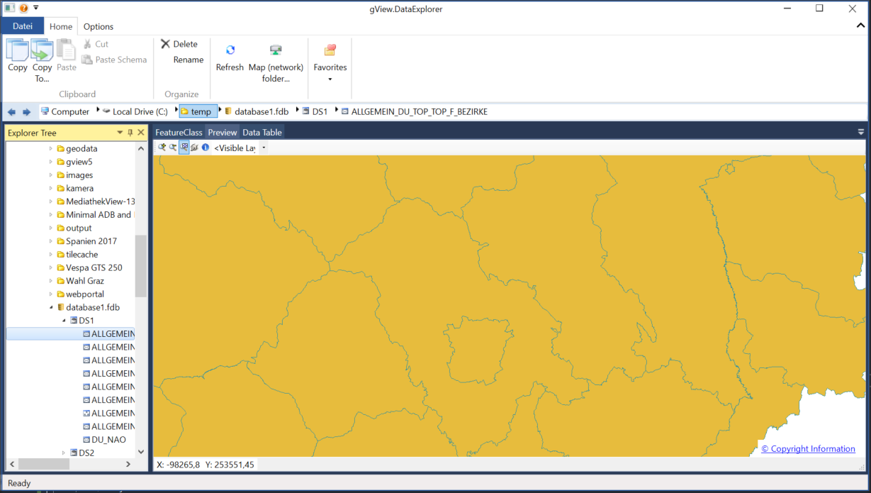
Browse your spatial data or copy vector data to different data formats
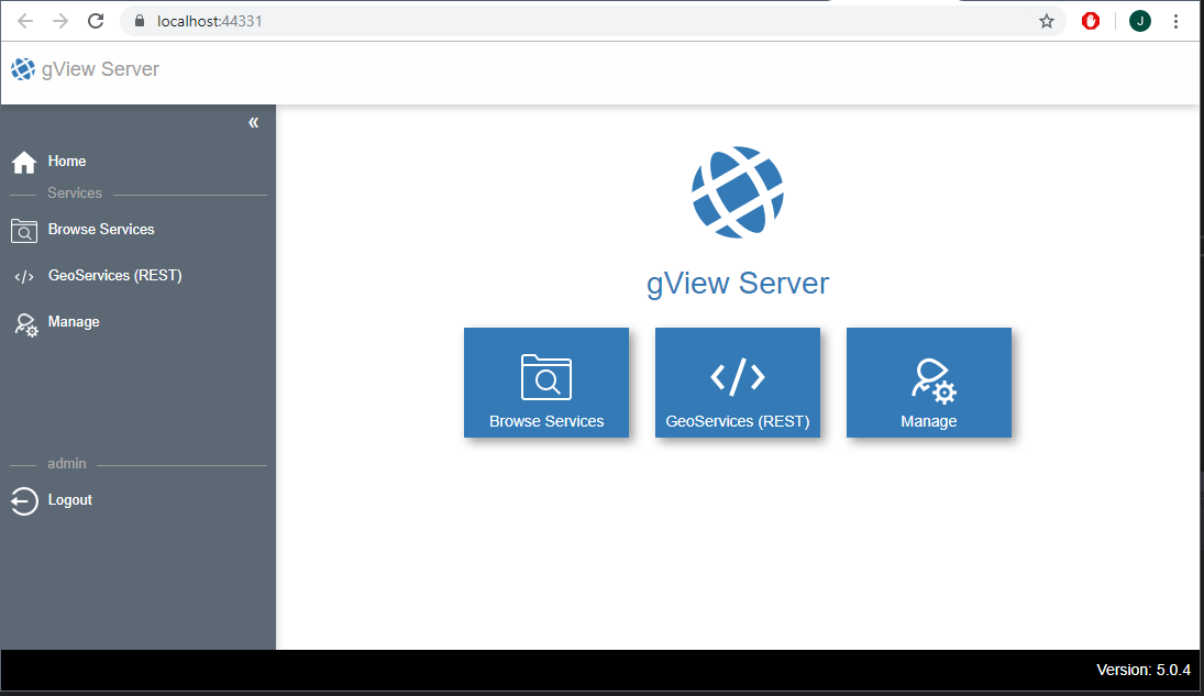
A map server that exports gView Carto map as GeoServices REST, ArcXML, WMS, WFS, WMTS services
Manage the services and check the service status (running, stopped, error)
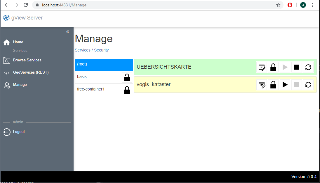
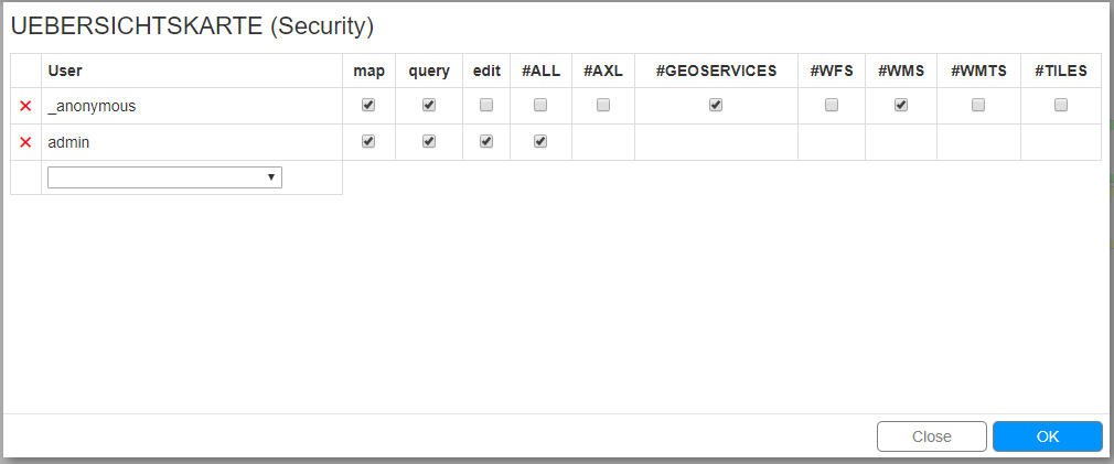
Set the security for a service or for a folder (group of services)
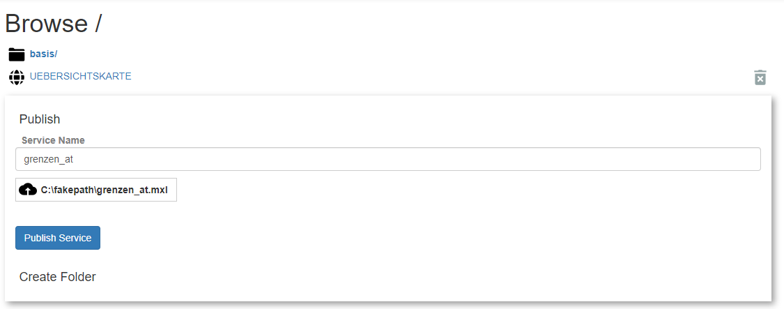
Publish services by uploading gView Carto map projects
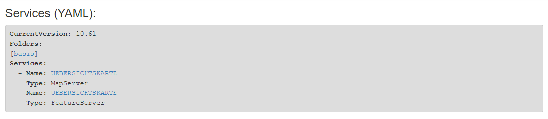
Browse the services via the GeoServices Rest API in YAML or JSON